
| Weather Data | |||
|---|---|---|---|
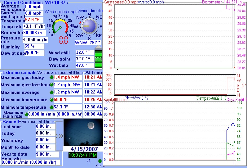
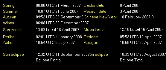
| LAST READING AT TIME: 10:07 PM DATE: April 15 2007 | |||
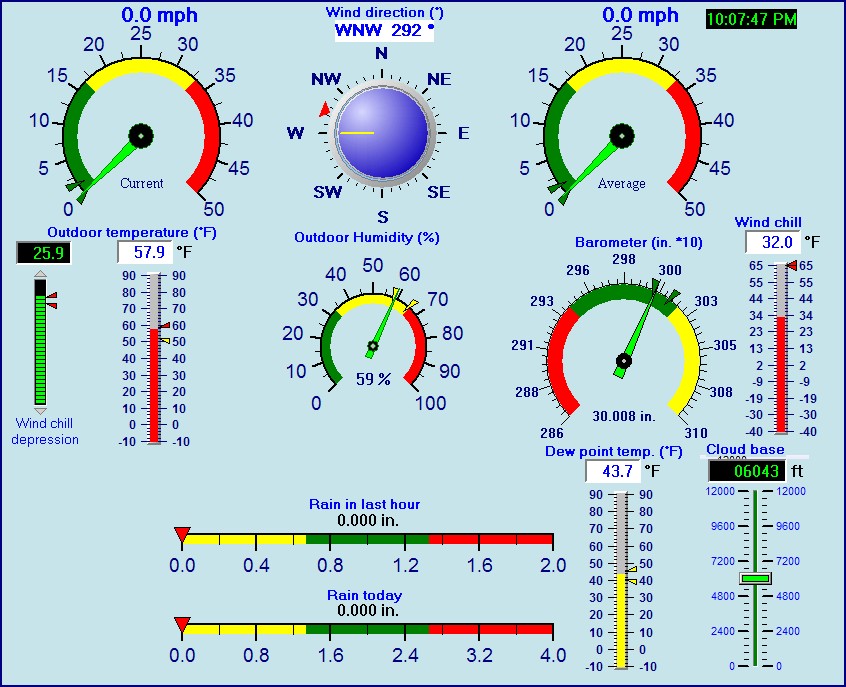
| Current Weather | Night time\Dry | Current Temperature | 57.9°F (14.4 °C), Apparent temp 56.3 °F |
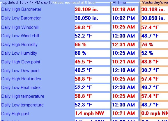
| Maximum Temperature (since midnight) | 58.8 °F at: 10:25 AM | Minimum Temperature (since midnight) | 52.3 °F at: 12:30 AM |
| Average windspeed (ten minute) | 0.0 mph | Wind Direction (ten minute) | W (270°) |
| Windchill Temperature | 32.0°F | Maximum Gust (last hour) | 1.2 mph at: 10:21 AM |
| Maximum Gust (since midnight) | 1.4 mph at: 10:21 AM | Maximum 1 minute average (since midnight) | 1.2 mph at: 10:22 AM |
| Rainfall (last hour) | 0.00 in. (0.0 mm) | Rainfall (since midnight) | 0.00 in. (0.0 mm) --- |
| Rainfall This month | 0.00 in. (0.0 mm) | Rainfall To date this year | 9.00 in. (228.5 mm) |
| Maximum rain per minute (last hour) | 0.00 in/min | Maximum rain per hour (last 6 hours) | 0.00 in/hour |
| Yesterdays rainfall | 0.00 in | DewPoint | 32.0°F (Wet Bulb :47.0°F ) |
| Humidity | 59 %, Humidex 54.0 °F | Barometer corrected to msl | 30.008 in. (1016.2 hPa) |
| Pressure change | -0.05 in. (last hour) | Trend (last hour) | FALLING |
| Pressure change (last 12 hours) | +0.00 in | Pressure change (last 6 hours) | +0.00 in |
| Current Indoor temp. 75.9 °F | |||
| Current Indoor hum. 36 % | |||
Use the RELOAD facility on your browser to retrieve the latest data.